
 |
Region 5-Bicol Region |
The Bicol Region or Bicolandia is one of the 17 regions of the Philippines. It occupies the Bicol Peninsula at the southeastern end of Luzon island and some other islands.
It consists of six provinces namely, Albay, Camarines Norte, Camarines Sur, Catanduanes, Masbate, and Sorsogon. It has one independent component city, Naga City, and six component cities, Iriga, Legazpi, Ligao, Masbate, Sorsogon, and Tabaco. The regional centers are Legazpi City, the region's political and administrative center, Naga City, the region's cultural and religious center. Legazpi City, Naga City, and Sorsogon City are the leading cities in the region in terms of urbanization and also the hub of the region's economic activity.
The Bicol Region is located at the Southeastern stretch of Luzon, the largest island in the Philippines, and is surrounded by natural barriers. It is bounded by Lamon Bay on the north, Pacific Ocean on the east, and Sibuyan Sea and Ragay Gulf on the west. It also has access to the rest of Luzon through its neighboring provinnce, Quezon.
Of the region's six provinces, four (4) are contiguous - Albay, Camarines Sur, Camarines Norte, and Sorsogon, while two are island provinces - Masbate, and Catanduanes. It has a total land area of 1, 811,400 hectares or 18,114 square kilometers. Camarines Sur is the largest occupying 526,682 hectares or around 30% of the total, while Catanduanes is the smallest with only 151,148 hectares or 8.6% of the total. Of the region's total land area, around 71% is alienable and disposable while the remaining 29% is public forest areas.
The people of the Bicol region, called Bicolanos, speak any one of the several varieties of Bicol, an Austronesian language closely related to other Central Philippine languages such as Cebuano and Tagalog. Bicol varieties include Bicol Rinconada (Iriga-Buhi area), the western Albay dialects Oasnun and Darageño (Oas, Daraga), Bicol Sorsogon (Sorsogon), Bicol Catanduanes and Bicol Partido (municipalities surrounding Lagonoy Gulf). Standard Bicol is based on the dialect of Legazpi City and is understood widely through out the region even though they cannot speak the dialect.
The Bicol languages are the dominant languages of the region. The Filipino language (Tagalog) is also spoken in northern parts of Camarines Norte as well as in the municipality of Del Gallego, Camarines Sur. Two Visayan languages, Sorsoganon and Masbateño or Minasbate, are spoken in Masbate and Sorsogon; they are collectively referred to as Bisakol.

Albay - Land Of The World's Most Perfect Cone
The province of Albay is located between Camarines Sur on the north and Sorsogon on the south. It is bounded on the east by the Pacific Ocean, on the northeast by the Lagonoy gulf, and on the west and southwest by the Burias Pass. The islands in the north under the jurisdiction of the province are Rapu-rapu, Bata, Cagraray, and San Miguel.
Albay has a land area of 2,552.6 square kilometers, consisting of 14 towns, and a population of 904,382. Its important products are hemp, coconut, sugar cane, pineapple, vegetable, and rice.
The mountains of the province are Mayon, Masaraga, and Malinao in the northeast and Catburaun in the west. Its forests are a source of timber, rattan, pili nuts, and gum elemi. There are also vast grasslands for pasturing horses, cattle, carabaos, goats, and sheep.
Geography
Located at the southern tip of Luzon Island and about 550 km. from Manila, Albay is approximately 13 to 13.5 degrees north latitude and 123.25 to 124.25 degrees east longitude. It is bounded by Lagonoy Gulf and the province of Camarines Sur on the northeast, the Pacific Ocean on the east, the province of Sorsogon on the south, and the Burias Pass on the southeast. It has a total land area of 2,552.6 km.
Political Subdivision
Albay is composed of three cities (Legazpi, Tabaco, Ligao) and 15 municipalities grouped into three congressional districts. Legazpi has been officially designated as the site of the regional offices.
Climate
Albay experiences no dry season, with a very pronounced maximum rain period from December to January. The western areas have more or less heavily distributed rainfall throughout the year and the central areas have no pronounced maximum rain period with a short dry season from November to January. The province averages 20 typhoons yearly, ranging from 60-180 kph. Average rainfall is 233 millimeters; average temperature is 33.15 Celsius high and 22.60 Celsius low.
Language / Dialect
Bicol, the local dialect, constitutes a strange variety in words and in diction among the 17 municipalities. Most puzzling is the amazing variation among towns of many words having the same meaning for one object or concept.
Bicol is generally spoken in Legazpi. The people speak Tagalog fluently and can communicate in English with ease.
Bicol is generally spoken in Legazpi. The people speak Tagalog fluently and can communicate in English with ease.
Industries
The province has continued to direct its efforts toward the development of its industries. Of the total 6,369 manufacturing establishments in the Bicol Region, half are located in Albay. 48.6% of the large scale lot are operating in Albay. Among them are the export-oriented Isarog Pulp & Paper Mills and Albay Industrial Development Corporation.
Agriculture, however, still accounts for the largest share in the total production and employment. Coconut, rice, abaca, and corn are the major crops.
Handicrafts are the main source of rural income.
Albay is a major supplier of geothermal energy to the Luzon Grid with its Tiwi Geothermal Plant in Tiwi.
History
In 1569, Luis Enriques de Guzman led an expedition from Panay to the islands of Masbate and Ticao as well as the region named Ibalon. The Augustinian missionary Father Alonzo Jimenez christianized the first inhabitants of Ibalon, Camarines, and Burias. He learned the Bicol dialect and composed a Bicol catechism.
In July 1573, Juan de Salcedo, with 120 soldiers, explored Ibalon and founded the town of Santiago de Libong. Jose Maria Peñafrancia, a military engineer, was made “Coregidor” of the province on May 14, 1834. He constructed public buildings and built roads and bridges.
Governor and Capitan General Narciso de Claveria issued a decree in 1846 separating Masbate, Ticao, and Burias from Albay to the Comandancia of Masbate. Albay was then divided into four districts: Iraya, Coldillera or Tabaco, Sorsogon, and Catanduanes.
Gilcerio Delgado, a condemned “Insurecto,” started the revolutionary activities in the province. With headquarters up the mountain of Guinabatan, he joined the revolutionary government of Albay as lieutenant of the Infantry.
A unit of the Philippine militia was then organized by the Spanish military authorities. Mariano Riosa was appointed major for the Tabaco Zone, which comprised all the towns along the seacoast from Albay to Tiwi, while Anacleto Solano was also appointed major for the Iraya Zone, which was made up of the towns from Daraga to Libon. Each town was organized into a section of fifty men under of the command of a lieutenant.
On September 22, 1898, the provincial revolutionary government of Albay was formed, with Anaceto Solano as provincial president. Major General Vito Belarmino, appointed military commander, reorganized the Filipino army in the province.
Although a civil government was established in Albay on April 22, 1901, Colonel Harry H. Bandholtz, Commanding Officer of the Constabulary in the Bicol region, attested that Simeon Ola, with a thousand men, continued to defy American authority after the capture of Belarmino in 1901. Ola was later captured along with about six hundred men.
During the Second World War, the Kimura Detachment of the Japanese Imperial Forces occupied Legazpi on December 12, 1941. The region was defended only by the Philippine Constabulary unit under Major Francisco Sandico.
By December 19, the Bicol Peninsula up to Sipocot, Camarines Sur, with patron towards Ragay gulf and Daet, was already under the enemy.
Albay, a progressive province, with its capital city of Legazpi, has a large reservoir of steam deposits in Tiwi, according to geothermal expert G.M. Gridley of New Zealand. On August 14, 1970, Presidential Proclamation No. 739 authorized the National Power Corporation to exploit and develop the Tiwi power plant project.
Mayon Volcano, major tourist attraction of the province, is known for its symmetrical, almost perfect cone that rises over 7,500 feet above sea level. It erupted 15 times, with the catastrophe of February 1, 1814 as almost destructive. Its lava buried the town and church of Cagsawa.
Tourist Attractions:


Cagsawa Ruins
A ground and lavish church during the Spanish era that was buried during the worst Mayon eruption on February 1, 1814. Originally the word was taken from Kagsawa – Kag means owner and sawa means phyton – which suggested a snake charmer. Today, only the belfry remains as a mute testimony of Mayon’s unpredictable fury and devastating strength and the Cagsawa Ruins Park affords tourists an unhampered view of the Mayon Volcano.


Albay Park and Wildlife
A picnic grove and a park all rolled into one, this place is the best way to commune with nature. Have a satisfying get-together with your family and friends while roaming the park, which houses 347 animals belonging to 75 species. The children can enjoy boat and bike rides, too. The park is situated near the foot of Albay’s famous Mayon Volcano.

Liberty Bell
A bronze bell installed in 1945 by the American liberation forces. This is enclosed within a dome-shaped concrete structure with this nscription, "Whenever oppression knocks at your door fee free to ring this bell."


Japanese Tunnel
40 meters long (L-shaped) and 7 feet deep. This tunnel was used by the Japanese forces as arsenal during WWII

Magayon Art Gallery
The only contemporary art gallery in the province of Albay, located at the lobby of the Albay Provincial Capitol. It houses changing exhibitions, particularly in the field of visual arts.


St. John the Baptist Church (Camalig)
It is another Missionary Church built out of volcanic rocks. Today, relics from Hoyop-Hoyopan cave are carefully stored and displayed here for viewing. These relics unearthed from the cave reflect the province’s historical origins. They manifest the early Malaysian influence through the buried jars excavated. Glazed ceramics reveal Chinese influence while the primitive potteries are derived from the flourishing Philippine culture many thousand years ago.


Our Lady of the Gate Church
This church was built in 1773 on top of a hill by Franciscan Missionaries in the growing town of Daraga, named after the “young maidens” who helped in the construction of the church. This is a priceless relic for art enthusiasts because of its rich baroque architectural design carefully carved on volcanic rocks, and its façade gives the church its special distinction from the other churches in the country. It contains archeological relics of “santos” and rare religious seals ingeniously carved throughout the entire face of the church, even up to the belfry.


Joroan Church
This is the site of the yearly pilgrimage to our Nuestra Señora de Salvacion, the Patroness of Albay. Every 3rd Saturday of August, the Joroan Chuch is flocked by thousands of pilgrims to pay homage to the Marian image.

Mayon Volcano
Mayon Volcano has a height of 2,242 meters (8,189 feet) and a base of 10 kilometers embracing several towns.
One’s visit to the Bicolandia is not complete without catching a captivating view of Mayon Volcano, the world’s most perfect cone and Bicol’s fiery maiden. Her name was derived from the Bikol word “Magayon,” which literally means beautiful. The peak, likened to the legendary beauty Daragang Magayon, is often concealed by clouds urging first-time visitors to stay longer to admire her charm. Despite her enigma which has left a trail of death and destruction brought about by her 15 eruptions, her tantrums have become spectacular fireworks displays to behold.

Mayon Skyline
It nestles on the eastern slopes of Mayon at the altitude of 2,700 ft. It is popularly known as “heaven on earth” because of the hanging clouds, and the pleasant climate, amusingly cool and romantically invigorating. From this height, visitors enjoy a panoramic view of the Pacific Ocean and the deferent towns, lakes, village, fields, sprawling hills, and mountains.

Pototan Cave
A four-hour spelunking adventure site, about 10 feet above the beach line. Its cave entrance is shaped like a yawning mouth, about 30 ft. high and 20 ft. wide. Once inside an underground river that spans around 12 ft. high calmly flows into the different chambers and passageways. Stalactites and stalagmites of various shapes, sizes, and contours are carved on craggy walls.


Calabidongan Caves
The name really means “Caves of the bats.” There is a grotto-like formation inside which astounds visitors. It is found in Camalig. It takes around 30 minutes’ trek inside Hoyop-hoyopan cave.


Kapuntukan Hill
Its contour and shape are like a sleeping lion, lying a kilometer away from the busy Legazpi pier. Atop this hill affords viewers to relish the beautiful vista of the entire city of Legazpi and the neighboring municipalities as far as the town of Manito and the alluring islands of Rapu-Rapu.


Misibis Island (Cagrary, Bacacay)
Misibis, a barangay in the island of Cagraray, is 17 km. away and is about 45 minutes by boat rude. It is noted for its almost fine white sands, with an irregular coastline stretching almost three km. facing the Pacific Ocean. A paradise for beach lovers, artists, and nature lovers, Misibis is an ideal place to enjoy swimming and discover the exotic marine life underneath.

Corangon Island (Tiwi)
Corangon, meaning coral, is a tiny islet formed by pulverized corals through thousands of years. By a strange twist of nature, these crushed corals surfaced above the sea line caused by the swirling turns of waves and sea currents, circling on and on until they evolved into an island. During low tide, the island is clearly apparent as one approaches the main town of Tiwi.
Cagraray Island (Bacacay)
A paradise found 20 km. from the town of Bacacay and about two hours by boat. In the island one finds the most significant among the caves discovered, namely: Cagbulacao Cave, Malubago Cave, Misibis Cave, Buhi Cave, and Mataas Cave. Beaches that are almost virgin and paradise-perfect can be found particularly in Misibis, Mosboron, and Sula.


Vera Falls
Located on a secluded nook of Mt. Malinao, about 400 ft. above sea level, this natural paradise of forest and clear cascading water is a treasure to behold. A snake-like trail along tree-filled rivers await you, trekking with endless enthusiasm. At its base, cold water deep for diving and fresh for drinking roar actively.

Palale Falls
In Malinao, this falls has been branded as a source of disastrous floods. During good weather, its cascading water, like the Bugsucan falls, is a splendid site because of its lush surroundings. It is very accessible by foot trails.


Busay Falls
It is considered as one of the highest waterfalls in the country because of its seven-tiered cascading white foam. It is estimated to have a vital height of 800 feet from the top. The first catch basin forms below where hundreds of bathers could refresh from the scorching heat of summer. It is accessible only by foot trail.


Sogod Beach
In Bacacay, it is the most popular beach which is well-known for its enclaves of black sandy beaches with towering coconut palms and lush vegetation providing cool shades. These beaches are closely adjacent to the national highways. Almost unspoiled, it is an excellent place for bathing and fishing.


Dhio Endeka Spring Resort
The newest and biggest spring resort in Albay with four swimming pools and a wide playground is located in Buang, Tabaco. Natural fresh water continuously pours into the pool. Recreational facilities which include boat rides and cottages for overnight stay are available.
Bugsucan Falls
This is a tiered waterfalls set on a beauteous mountainside. Its cascading water blends perfectly with its natural springs. It is a recommended site for bathing, picnics, and photography.
San Lorenzo Beach
The clear and almost unspoiled beach has lured hundreds of tourists to this place in Tabaco. Its strategic location has commanded a breathtaking view of Tabaco Bay and the green soft-looking and quiet island of San Miguel.
Kalayukai Beach Resort
The sunrise is very beautiful to watch on this beach. Gazebo and bancas are available for hire for visitors who would like to see the clear blue water where eye-catching corals of varied forms could be viewed even without the use of goggles.
Legazpi City Museum
Historical and archeological relics of the city’s gentry are artfully displayed here for public viewing. It also serves as an art gallery for Bicolano artists.
Philippine National Museum
This is situated near the Cagsawa church ruins. It is maintained and managed by the National Museum. The museum showcases the cultural history of the region based on the significant archeological finds found in the provinces of Albay, Sorsogon, Camarines Sur, and Masbate. Included in the Cagsawa museum exhibits are the geological history of the province, for the appreciation and enrichment of the viewing local and foreign visitors.
Festivals :
Magayon Festival (May 1-31)
It relieves the origin of Mayon Volcano. Observed in May, the festival features sports and cultural events and trade fairs. The focus of the month-long event is the stage reenactment of the tragic love story of the legend of Daragang Magayon and Panganoron whose fatal deaths gave birth to the volcano. Legend has it that Magayon’s grave became Mayon while the clouds kissing her is Panganoron.
Ibalong Festival (second week of October; Legazpi)
A week-long festivity recounting the brave exploits of the heroes of Ibalong or prehistoric Bicol. The festival is highlighted by a street parade recreating the classic battles between heroes and beasts of Ibalong.
Tabak Festival (Tabaco City)
Sarung Banggi (May 18-25; Sto. Domingo)
An annual fun-filled eight-day summer festivity immortalizing the timeless love song Sarung Banggi, and a tribute to its composer, Potenciano V. Gregorio. The Sarung Banggi festival showcases a variety of cultural and religious activities. The entire colorful performance is shown at nighttime when the street parade routes are brightly lighted with large torches. The whole town becomes a true picture of rural life with the multitude of people occupying the streets to watch and join the nighttime merriment.
Coron Festival (Tiwi; third week of August)
A showcase of events highlighted by a street presentation participated in by the town’s different public and private schools and sectors gives a week of fun and merriment to visitors and locals. The religious package of devotion and prayer in honor of Albay’s patroness, Nuestra Señora de Salvacion (Our Lday of Salvation), is the peak event of the festival, colorfully drawing thousands of devotees and religious groups through a long maritime procession of different local sea vessels on the sea spray of the serene Pacific ocean going to the quiet barangay of Joroan, the home of the miraculous image.
Kadagatan Festival (Bacacay; Black Saturday)
Formerly called the Bancathon race, the festival is a water sport activity participated in by fishermen from the different municipalities of Albay aimed to give recognition and at the same time provide a venue to the fishermen to show their strength, skills, and contributions to the socio-economic development of the region.
Pagsuwak Festival (Guinobatan; August 9-15)
The act of thanksgiving for Guinobatan’s growth, development, and progress, fitted in with the people’s gesture of offering for the bountiful harvest.
Katalingkasan Festival (Libon; 2nd week of July)
The festivity retraces the valiant story of the virgins of the town who worked hard in making Libon as one of the earliest settlements in Albay. Featured activities are trade fairs, shows, and street dancing.
Salingoy Festival (Bacacay; August 9-15)
Salingoy is a Bikol term that literally means looking back. A century of devotion (1901-2001) to one of Bacacay’s patron saints, Nuestra Señora de los Samparados, Salingoy Festival came into being, a centennial commemoration of unbroken reverence to God’s blessings and bounty. Salingoy looks back with humility by reminiscing into the richness of fidelity to Our Lady (Holy Mother Mary) and to relive Bacacay’s historical, socio-cultural, and religious heritage.
Tinagbuan Festival (Ligao City; December 25)
This festivity is in honor of the city’s patron saint, St. Stephen Protomartyr. Tinagbuan, from the term tagbuan, which means converging point, is exactly the essence of this festival as it enables Ligaoeños to come back to Ligao for a blessed reunion with their families and friends. The festival’s highlight is the street dance presentation.
Pilgrimage to Joroan (Tiwi; 3rd Saturday of August)
This yearly pilgrimage to Nuestra Señora de Salvacion, the patroness of Albay, is highlighted by a maritime procession and a concelebrated Mass on the shores of Sogod Beach. Thousands of pilgrims from different places flock to pay homage to the Marian image
Special Interest :
Ceramics / Pottery
The province is noted for finely crafted jars and pottery from the municipality of Tiwi.
Hand-Made Paper
Also of note are the fine-quality hand-made paper products from the municipality of Sto. Domingo.
Pili Nuts
The stinging taste of Bicolano cuisine is neutralized by the sweetness of pili, a nut which is made into various confections.
Gastronomic Delights
Relish Bicolandia’s mouth-watering indigenous cuisine, notably, Bicol Express (spicy pork and shrimp concoction), cosido (fish soup), balaw (small shrimps), natong, candingga, and pinangat. These are made more flavorful by the Bicolano’s penchant for spice.
Abaca Products
Albay’s prime souvenirs are abaca products creatively crafted into infinite creations such as home decor, office and personal paraphernalia and exported worldwide. Abaca is considered the world’s strongest fiber. These souvenirs are abundant in Daraga and Tabaco.
Albay / Bicol Trekking
The Bicol region, a narrow trail of land running south from Manila, is studded with volcanoes, and offers a different and exciting experience for mountain climbers. Popular climbs in the area include Mt. Bulusan, Mt. Isarog, and the perfect towering cone of Mt. Mayon, which has one of the finest summit views in the country. However, Mayon is definitely active – it erupted in 1968, 1978, 1984 and 1993. It is constantly monitored by geologists who post warnings of imminent danger. You should consult the local authorities before trekking here.
Mountain Biking
The Sabluyon route is a good introductory ride near Legazpi City. The trail takes you on an 80km tour around the base of Mt. Mayon, with an optional, but steep, detour to the Mayon Rest House where you can spend the night if you want to take a break. The entire route is on roads and, if you omit the Mt. Mayon detour, most of the grades are quite modest. It's a good introduction to the terrain without massive exertion and, of course, you'll have an eyeful of Mt. Mayon from all angles. The Mayon Rest House trip includes a very steep 9km uphill section, but the road is good and the spectacular views from the top make it well worth the effort. Watch out on the way down, especially for reckless speeding vehicles on the roads.
Economic
Geothermal Electric Power
An electric power project with geothermal energy as source, it is designed to generate more than 333 megawatts of power, It is operated jointly by the NPC/NEA and Union Oil (USA). Located in Tiwi, Albay, it is mostly visited because of its high educational values.
Salt Making Project
Another Tiwi pilot industrial project using geothermal steam as main ingredient. It was established hand in hand with the development of the Tiwi Geothermal Plant, and aimed to provide opportunities among the people in the area.
Camarines Norte - Bicolandia's Goldmine
The province of Camarines Norte is found in the northern coast of the Bicol peninsula, which forms the southeastern section of Luzon, the largest island in the Philippine archipelago.
One of the six provinces that make up Region V, it is bounded on the north by the Pacific Ocean, on the east by San Miguel Bay, on the west by Lamon Bay, and on the south by Quezon province and the adjoining province of Camarines Sur.
It is characterized by rolling hills and mountains in the interior, and the fertile plains and valleys along the coast. The land of the province is largely within the 0-8% slope, with 72,483 hectares or 32.95% of the total land area.
Geography
The province is bounded on the north by the Pacific Ocean, on the east by San Miguel Bay, on the west by Lamon Bay, and on the south by Quezon province and the adjoining province of Camarines Sur. It has a total land area of 220,012 hectares or 2,200 square kilometers, which is 12.4 % of the total Bicol area and 0.73% of the total Philippine area.
Political Subdivision
Camarines Norte is composed of twelve municipalities, & has a total of 282 barangays. Labo has the biggest land area and the most number of barangays; Talisay is the smallest town; and San Vicente has the least number of barangays.
*Basud
*Capalonga
*Daet
*Jose Panganiban
*Labo
*Mercedes
*Paracale
*San Lorenzo Ruiz
*San Vicente
*Sta. Elena
*Talisay
*Vinzons
Language
Bicol is the major dialect spoken, along with Tagalog and English.
Climate
Camarines Norte belongs to the second type of climate with no dry season and with a very pronounced maximum rain period from November to January. Average annual rainfall in 2000 was 389.58 millimeters. Average temperature is 27.3 oC. The coolest months are January and February and the warmest is May.
Industries
There are four major manufacturing and processing industries in the province, which are given priority in terms of promotion and development. These are jewelry craft, gifts/toys/housewares, pineapple and coconut industry.
History
From 1573 to 1829, Camarines Sur and Camarines Norte formed only one political unit known as Ambos Camarines. They were separated in 1829 but reunited in 1854. They again separated; to be reunited again in 1893. This union continued until 1919. On March 3, 1919, Camarines Norte was finally segregated from Ambos Camarines by the Philippine Legislature in Act 2809.
When Camarines Norte was separated from Ambos Camarines in 1829, it was assigned the towns of Daet (capital), Talisay, Indan (now Vinzons), Labo, Paracale, Mambulao (now Jose Panganiban), Capalonga, Ragay, Lupi, and Sipocot. Seventeen years later, it lost Sipocot, Lupi, and Ragay to Camarines Sur in exchange for the town of Siruma.
Juan de Salcedo, dispatched by Legaspi to explore the island in 1571, influenced the existence of Camarines Norte. After subduing Taytay and Cainta, he marched further across Laguna and Tayabas. He visited the gold-laden towns of Mambulao and Paracale, obsessed by what he heard from natives of there existing gold mines in these towns.
When Francisco de Sande took over from Legaspi as Governor-General, Spanish influence started to be felt in the region. He established a permanent garrison in Naga to control the region and defend it from Chinese and Muslim pirates. Captain Pedro de Chavez was assigned to head this force.
There were already native settlements in the province when the Spaniards arrived. The flourishing towns of Mambulao and Paracale were two of them. Indan and Daet were the other settlements, besides Capalonga and others. But Paracale remained the most sought after, the most prosperous, because of its gold mines.
The towns were chiefly inhabited by Tagalogs; the rest were of Visayan strain. However, most of the immigrants were from Mauban, Quezon. The Spanish missionaries did not falter in their mission to christianize the natives.
By virtue of Act 2809 of March 3, 1919 Governor General F.B. Harisson separated Camarines Norte from Camarines Sur, later appointing Don Miguel R. Lukban as its first Governor. At present it has 12 towns: Basud, Capalonga, Daet, Jose Panganiban, Labo, Mercedes, Paracale, San Lorenzo Ruiz, San Vicente, Sta. Elena, Talisay, and Vinzons. Daet remained as its capital town.
Tourist Attractions:

First Rizal Monument
The first Philippine monument to the National Hero, Dr. Jose P. Rizal, can be found in Daet. This historical landmark stands on the corner of Magallanes and Justo Lukban Streets, facing the Daet Municipal Hall. It is a three-tiered stone pylon with its square base supporting a triangle in two stages, the last one tapering off to a point. Built in 1898, the First Monument of Rizal in the Philippines is located across the Old Daet Municipal Hall. Its foundation, it is believed, is made of mortars and boulders from the demolished Old Spanish Jail in Daet where many patriots died, making it historically and culturally significant.

Provincial Capitol
Camarines Norte has one of the most beautiful Provincial Capitols in the entire country. Reconstructed from 1986 -1995, it provides a permanent seat for the Provincial Government. It has 12 big front columns or posts representing the 12 municipalities of the province.


Town of Vinzons
The town of Indan was renamed Vinzons in honor of Wenceslao Q. Vinzons, a hero during the Japanese War. His residence has been converted into a shrine and public library containing his memorabilia.

Jose Panganiban’s Monument
Located right in front of the Municipal Hall of Jose Panganiban, it is where the remains of the martyr have been interred.

Laniton Park
It is the site of the first guerilla encounters against the Japanese Imperial Army. It is located in Basud, some 15 to 20 minutes from Daet.
Vinzons Catholic Church
One of the oldest churches in the Philippines; located at Vinzons town proper, which celebrated its 400th year anniversary in 1981.


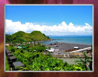
Bagasbas Beach
The most popular beach resort in the province is in Barangay Bagasbas, Daet. You reach it after a five-minute ride on any type of motor vehicle from Daet poblacion. The beach has a long and wide expanse of fine gray sand. During clear but windy days, the big waves that roll in from the Pacific Ocean make it a paradise for surfing beginners and afficionados. It is considered one of the most beautiful beaches in the country.

Mercedes Group of Islands
The islands can be reached in an about 30 to 45 minute motorboat ride from Mercedes town proper. The major attractions in these islands are its clean white beaches, corrals, underwater sceneries, rock formations, and fish sanctuary. Additional come-ons are scenic landscapes and seascapes, the attractive lighthouse in Canimog island, unexplored Canton cave, and the different types of seashells and tropical fishes that abound. The place is good for island hopping, swimming, bird watching, boating, snorkeling, trekking, scuba diving, golf in Apuao Grande Resort, jet skiing, spear fishing, and other related activities.


Mangcamagong Beach
This is a clean gray beach facing San Miguel Bay with clear water suitable for swimming and outings. Its scenic and peaceful ambience provides excursionists and tourists a nice place for relaxation. Cottages, restrooms, roadside eateries, and sheds are available to tourists at reasonable prices. Here, you can broil capiz shells – a delicacy.


Mampurog River
This river is wide with clear and deep cold water, a nice place to wade in and explore. It is a very popular choice for swimming, excursions, and picnics during summer.
Palay. Rice areas in the province are composed of 6,412.38 hectares of irrigated farms and 3,162 hectares of rain-fed land. The major rice growing areas are Daet, Talisay, Vinzons, Labo, and Basud. In 2000, the province harvested 53,644.12 metric tons of rice grains in two croppings.
Palay. Rice areas in the province are composed of 6,412.38 hectares of irrigated farms and 3,162 hectares of rain-fed land. The major rice growing areas are Daet, Talisay, Vinzons, Labo, and Basud. In 2000, the province harvested 53,644.12 metric tons of rice grains in two croppings.


Mananap Falls
Located in San Vicente, roughly 18 kilometers west of the capital. To reach it, one has to hike uphill for two kilometers but the deep cool waters of the falls are worth the climb.


Imee-Irene Twin Falls
Located in Sta. Elena, it is still virtually unexplored because of its great distance from Daet.

Colasi Falls
Located in Colasi Mercedes, it is an aesthetic falls in the midst of the forest which could be reached through hiking. The falls has an approximate height of 70 ft. offering a good place for swimmers and nature lovers because of its flashing blue cool water. It can be reached in about one hour by jeepney from Daet to Baronage Colasi plus a 3-hour hike from Colasi to the falls.

Lanot Beach
Fascinating for its spring; 30 km. south of Daet. Barangay Lanot of Mercedes can be reached by banca or motorboat through Barangay Hinipaan, 15 km. from Daet.

Pag-asa Beach
Located 46 km. northwest of Daet and 3 km. from Jose Panganiban. Popular among swimmers, picknickers, and promenaders.
Itok Falls
Located about 79 km. northwest of Daet, 4 km. west of Capalonga. Fresh and lush foliage and vegetation make it more romantic; its scenic vista soothes tired souls and heavy hearts.


Canton Cave
It can be reached in 45 minutes by motorboat from Mercedes town; inviting to the adventurous; exploring it is timed with the tide’s ebb and flow.

San Jose Beach
Wide beach with fine sand; a 15-minute ride from Daet and Talisay; ideal for picnics and swimming.
Pulang Daga Beach
It can be reached in two hours by bus from Daet and Paracale; frequented by picknickers and swimmers; made a setting for a film; clean white sands and swimming-safe cove; with cottages for rent.


Apuao Grande Island Resort
It can be reached in 15 to 30 minutes by motorboat from Mercedes; complete with hotel/cottages, swimming pool, restaurant and bar, and a golf course; caters mostly to foreign tourists.
Bulalakao Beach
Crystal clear water and white sandy shores; located at Luklukan Sur, about 9 km. from Jose Panganiban town proper; inviting to swimmers and picknickers.


Calalanay Island Beach
Located in Calaguas Island, Vinzons.
Bitukang Manok
The DPWH rest house in the Bicol Natural Park. Located about 21 km. from Daet; 35 minutes by bus or jeepney; features winding road, lush vegetation; ideal for camping and picknicking.
Black Nazarene
The Capalonga Fiesta in honor of the Black Nazarene draws devotees from all over the country. The image is said to be miraculous and its feast is particularly celebrated by Chinese businessmen from all over the country, who pay annual homage and ask for long life and good fortune.
Senakulo
The observance of the lenten season is also done through a Senakulo, a re-enactment of the Passion of Jesus Christ every Good Friday in the municipality of Paracale.
Huli White
Fluvial procession in Vinzons in honor of Nuestra Señora de Peñafrancia in Daet, which takes place a week after the Peñafrancia celebration in Naga City, Camarines Sur.
Festivals
Pineapple Festival (June 15-22)
It showcases the famous and sweetest queen pineapple of the “Formosa” variety abundantly growing in the different municipalities of the province. It also highlights the unique and interesting features of the place and its people.
Foundation Day of Camarines Norte (April 15)
A week-long celebration of the foundation anniversary of the province. Highlighted by a commemorative mass, civic military parade, agro-industrial fair, exhibits, sports festivals.
Vinzons Day (September 28)
Commemorative of the birth anniversary of hero Wenceslao “Bintao” Q. Vinzons, Sr., native of Vinzons (formerly Indan). Highlights consist of a commemorative mass and program, lecture-forum on the life of the hero, DBC/LYRE competition, parade.
Pabirik Festival (January 26 – February 2)
A festival showcasing the rich mining industry in the town of Paracale. The festival is a presentation of its distinct culture and people’s way of life through street presentation, exhibits, and competitions. It also puts into focus their town fiesta on February 2.
Palong Festival (May 10-13)
Highlighted by streetdancing and agro-industrial fair which expresses the local folks’ gratitude for their town’s name’s etymology, and signifies the abundant presence of roosters available in the locality. Held also in celebration of the Black Nazarene’s Feast Day on May 13 at the town of Capalonga.
Sea Foods Festival (October 24)
A celebration featuring the distinct variety of fish available in the town of Basud. The presentation includes food fair, exhibits, and sea-related competitions such as bancathon and fishing.
Busig-On Festival (September 8)
A festival based on the epic of Busig-On of Labo town, which exemplifies heroism and Bikolano values. The festival features the town’s distinct historical values and sentiments through talent and skills competitions featuring the town’s places of interest.
Animal Festival (October 4)
A celebration of the Feast of St. Francis of Assisi, considered to be the patron of livestock raisers, which highlights the local history and culture. The festivity includes street dancing, beauty search, and skills competitions.
Kadagatan Festival (August 18)
A festival conducted in the town of Mercedes featuring various dishes from the bounty of the sea. Highlights are presentation of boat racing, street dancing in colorful attire, beauty search, exhibits and other competitions.
Boyoboy Festival (November 8)
A week-long celebration aimed to promote agricultural products, especially the Queen pineapple and tourism as a whole. “Boyoboy,” which literally means ”pagkaborogkos” in the vernacular, depicts the unique post harvest activity locally practiced by the people. Highlights are the industrial fair, beauty tilt, cultural presentation, investment program, and different sports events. San Lorenzo Ruiz is the origin and home of the Queen pineapple which has made Camarines Norte famous.
Mercedes Fishing Village/Community
Quaint for its original way of bidding fish catch by whisper; virtually the hub of the fishing industry of the province; interesting to sociologists, social scientists, sociology buffs because of quaint customs related with the fishing industry; also features fluvial procession during its town fiesta every June 13 called “Caracol”; at the height of the fishing season, its bay fills with fishing vessels.

Camarines Sur - World's Smallest Fish & Higher Climbs
Camarines Sur is home to the smallest fish in the world and famous for its Mt. Isarog, lots of beaches, old churches, and many splendid attractions.
It is 328 kilometers south of Manila, has 4 Congressional Districts and has 1,053 barangays. Total land area is 526,682 hectares populated by 1,551,549 persons.
Foundation Anniversary is every May 27, coinciding with the Kaogma Festival.
It is 328 kilometers south of Manila, has 4 Congressional Districts and has 1,053 barangays. Total land area is 526,682 hectares populated by 1,551,549 persons.
Foundation Anniversary is every May 27, coinciding with the Kaogma Festival.
Geography
The province is geographically located in the central part of the Bicol peninsula, which forms the southeastern part of the island of Luzon. It is about 450 kilometers from Manila and is located between 14º10' and 13º15' North Latitute and between 124º10' and 122º40' East Longtitude. It is bounded on the north by the provinces of Quezon and Camarines Norte, San Miguel Bay, and the Pacific Ocean; on the south by the province of Albay; Lagonoy Gulf on the east; and Ragay Gulf on the west.
Language/Dialect
Bikol is the local and most common dialect, with Naga Bikol as the standard version. English and Tagalog are likewise used. A growing number of Chinese and Muslim communities speak their own languages.
Political Subdivisions
Camarines Sur is composed of 35 municipalities and two cities, Naga City classified as an independent component city and Iriga City as a component city. Pili is the capital town. There are 1,065 barangays and four congressional districts.
Industries
Camarines Sur is the agro-industrial center of Bikol, followed by trade, manufacturing, and construction. Labor force is abundant, strong, and efficient. Among the priority investment sectors are marine and agriculture followed by non-metallic mineral processing, metal works, processed foods, beverages, furnitures, garments, and gifts and housewares.
With the proposed establishment of ecozones in at least five identified locations in the province and the intensifying campaign on the promotion of Bicol tourism, more investors are expected to arrive.
With the proposed establishment of ecozones in at least five identified locations in the province and the intensifying campaign on the promotion of Bicol tourism, more investors are expected to arrive.
History
In 1569, Luis Enriquez de Guzman, with Augustinian friar Alonzo Jimenez, reached the present town of Camalig, then a thriving village or rancheria. They found the natives living in thatched sheds called “kamalig”, which translates to ""rice granary."" Andrez de Ibarra, while in search of provisions, followed the route taken by de Guzman and reached Kalilingo and Bua (the present towns of Bato and Nabua) in 1570.
In 1573, Miguel Lopez de Legaspi dispatched Juan de Salcedo, grandson of Miguel Lopez de Legaspi, to explore the region as far as Paracale in search of gold and other precious stones. A year later, Salcedo cruised the Bicol River and reached Bato Lake. Hence, the first recorded account of the discovery of the place.
In 1574, at the height of the Spanish colonization of the islands, Guido de Lavizares mentioned in his letter to the King of Spain the land of ""Los Camarines"" – apparently referring to the area of what is now Camalig, Albay, where rice storehouses and granaries or “camarin” abound. Thus, the name “Camarines” was coined and somehow stuck. Spanish colonizers later denominated the area into two distinct aggrupations.
Later, a Spanish garrison under Captain Pedro de Chavez was set up in Naga, a prosperous native rancheria. In 1575, de Guzman founded the Naga City, calling it Nueva Caceres after the birthplace of Governor General Francisco de Sande in Caceres, Spain.
On May 27, 1579, Governor General de Sande issued a decree which led to the establishment of a settlement in Camarines where Spanish colonists were urged to reside.
In 1636, Ibalon was split into two: Partido de Ibalon (comprising what is now Albay, Catanduanes, Sorsogon, Masbate, and the islands of Ticao and Burias) and Partido de Camarines (all towns north of present-day Camalig, Albay).
Partido de Camarines was further divided into Camarines Sur and Norte in 1829. From 1864 until 1893, Camarines Norte and Sur (collectively called Ambos Camarines) underwent a series of confusing geo-political division, fusion, re-division, and re-fusion, until in 1919 when Norte and Sur were finally separated into two provinces by the first Philippine Legislature. Its capital town then was Naga, the city once called ""Nueva Caceres"" – namesake of a province in Spain and among the original five royal cities of the colony.
The Philippine Revolution started in Ambos Camarines on September 17, 1898 when Elias Angeles and Felix Plazo, Filipino corporals in the Spanish Army, sided with revolutionists and fought the local Spanish forces. With the arrival of General Vicente Lukban, the revolutionary government in the Bicol region was established.
The American forces occupied the Bicol peninsula in January 1900. In March of the same year, General John M. Bell was made the military governor of Southern Luzon. Civil government was finally established in Ambos Camarines in April 1901.
In March 1919, the Philippine Legislature issued an Act authorizing the Governor General to divide the province into Camarines Norte and Camarines Sur.
During the outbreak of World War II, Wenceslao Q. Vinzons waged underground operations and organized guerilla units against the Japanese troops stationed in Camarines Sur. After the capture of Vinzons on July 8, 1942, Lieutenant Francisco Boayes carried on with the guerilla movement. In April 1945, Camarines Sur was finally liberated from the Japanese invaders.
Naga City was the capital of Camarines Sur until June 6, 1955 when Pili, the adjoining town, was declared the Provincial Capital by virtue of R. A. 1336. The province celebrated its foundation anniversary, the 419th, for the very first time in May 27, 1998.
Tourist Attractions:


Naga City Museum
Located inside the University of Nueva Caceres campus, the UNC museum is one of the oldest museums outside Manila and recognized by the International Association of Museum. It houses historical artifacts of the ancient Bicol, its people and its culture

Leaning Tower Of Bombon
It is Camarines Sur’s counterpart, or perhaps an exact replica, of the very famous Leaning Tower of Pisa in Rome. A 15 minute drive from the City of Naga to Bombon.

Provincial Capitol Complex (Pili)
The seat of the provincial government of Camarines Sur. A prime tourist destination that offers recreational facilities and eco-tourism wonders found within 180 hectares of land at Brgy. Cadlan.


Peñafrancia Basilica Minore (Naga City)
Situated in a three-hectare lot along Balatas road, it is home to the miraculous Virgin of Peñafrancia (Patroness of the Bicol Region) and the Divino Rostro (Holy Face). The feast is celebrated during September of every year.

Ladrillo Church of Quipayo
Constructed in1616, this unique brick-made church is located in Calabanga. Rare artifacts were excavated in this church and they are now well-displayed in a museum behind the church altar.


Aguirangan Island (Presentacion)
Roughly 30 minutes from Brgy. Sabang, San Jose by motorized banca and half that time or even less by speedboat. Its small size, relative accessibility, and white beach made out of powdered corals make it a favorite excursion site. Has an area of approximately 1.5 hectares, surrounded by beautiful coral formations stretching a kilometer or more on the eastern side. Scuba diving and snorkeling are popular activities in the island. Kalupnitan Caves (llibmanan)
Has one of the most magnificent stalactite formations in its interiors. The caves contain countless stalagmites, stalactites, and pillars ranging from massive to delicate. Millions of bats emerge wildly from these caves, a rare but fearsome spectacle.


Gota Beach (Caramoan)
Composed of two caves called Little Gota and Big Gota, which are the main attractions of the Caramoan National Park. Located in Barangay Paniman about five kilometers from the town proper, a group of limestone islets known as the Malarad Island Group can be found. One can enjoy a stretch of sugary fine white beach comparable to that of Boracay, a salt water lake, and wildlife.

Adiangao Caves (San Jose)
Series of caverns located in Barangay Adiangao. Has three mouths and a 300-meter canopy stretching further up into the Calinigan Mountains. Stalactites, stalagmites, and huge columns and pillars adorn the ceiling and floors. Dripstone formed like icicles and suspended waterfalls can also be found. Caramoan Sea Kayaking
The Caramoan Peninsula, off Bicol, provides a totally untouched environment for kayakers willing to bring their own boats. This area is totally unknown to tourists so do not expect hotels or restaurants. But if you are looking for an outer-edge ocean experience, you will find it here. The Caramoan area is hit by typhoons so plan your expedition in the quiet months between December and June.


Itbog Falls
Located in Sta. Cruz Buhi, Camarines Sur. It has a twin waterfalls cascading amidst verdant vegetation. It could be reached by means of a banca from the town proper of Buhi and then a 30-minute trek.

Mt. Iriga
Distinct volcano with an elevation of about 4,823 feet. It is a very noticeable landmark. Its eruption in 1611 had caused the existence of Lake Buhi in the province.


Mt. Isarog
Situated just outside the town of Naga, rises to 1976m and overlooks San Miguel Bay, Lagonoy Gulf, the rugged Caramoan Peninsula and the fertile lowlands around Naga. This is a dormant volcano-its last major eruption was in 1641. Mt. Isarog is the second-highest mountain in Bicol and has one of the area's largest concentrations of virgin rainforest with a wide variety of rare plant and animal species.


La Roca Encantada
An enchanting island within the scenic lake of Buhi. It could be reached by means of a banca from the town proper of Buhi.


Animasola Island (Balatan)
Exotic rock formations and crystal clear waters welcome visitors travelling off the coast of the town.


Consocep Mountain Resort (Tigaon)
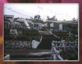
A 45 minute ride from Naga City and located at Brgy. Consocep. The resort is nestled on the shoulders of Mt. Isarog at an elevation of 1,800 ft. above sea level. Cool mountain air; two big waterfalls, Tuaguiti and Bulalacao, and smaller ones, most popular being Kawa-kawa; rest area, concrete stairways made of natural flat stones; flowers, butterflies, and tall trees make for an interesting scenery.


Daruanak Island (Pasacao)
About 15 minutes by boat and 10 minutes by jeepney from the town proper. Located off the coast of Poñgol and Balogo Beach; ideal for skiing; home to sea anemones, starfish, sea urchins, and other marine life.

Calapnitan Cave
Found in Libmanan, it contains innumerable stalactites and pillars ranging from massive to extremely delicate. Thousands of bats are housed in this cave, presenting a very extraordinary spectacle. Their presence provides a very good source of guano supply and phosphate.

Sabang Beach
Located in San Jose, it has a sandy white beach and shallow clear placid bathing water which is strongly fit to the climate in the area.


Atulayan Island
In this cinema-like paradise of an island, you can easily complete your collection of rare shells and stones. It was once the site of the French-Italian movie, “Mutiny in the South Seas.” Its ivory-colored beaches provided the best setting for the movie.


Nato Beach
Its beach is long with clear water and a gradual sea depth. It is accessible by car.


Omang Cave
Situated in Barrio Paniman, Caramoan, its entrance is about 30 feet above sea level and the interior is architecturally designed. The air is very cool inside. It is dark and, if lighted, shows grandiose beauty.


Caramoan Beach
The one beach in the country that can match Miami Beach in Florida.


Lake Bato
An inland lake which is a selected habitation of wild ducks and a choice site for duck hunters.


Malacsay Falls
Located in Mt. Isarog in Panicuason, it is 40 feet in height and the cascading water falls on a wide pond. A strong potential as a tourist attraction in the province, it could compete with other leading waterfalls in the Philippines like the Pagasanjan Falls.

Lake Buhi
At the eastern side of Mt. Iriga, picturesque Lake Buhi is about 105m above sea level, surrounded on all sides by hills more than 300m high. Sinarapan, the smallest commercial fish in the world, is found in the lake. It measures about three to four millimeters long and one spoonful would hold a thousand of them.


Gota Beach
Located in Caramoan, this lovely white beach lies between two small hills. Fronting the beach are three unspoiled islets.

Rose Islet
A small islet near the town of Presentacion. Its white sandy beach is good for swimming and snorkeling.
 |
| Bag-ing Island |
 |
| Isla de Moteverde |
 |
| Lahuy Island |
 |
| Bichara Island |
 |
| Bichara Island |
Festivals :
Tinagba Festival (February 11)
Annual celebration in Iriga City that coincides with the feast of Our Lady of Lourdes. Featuring the parade of bull-carts fully laden with harvested crops, which wind up the grotto of Our Lady of Lourdes where an offering of these crops is made as a token of thanks for the year’s bountiful harvest.
Boa- Boahan Festival (May 1-2)
A colorful cultural festival of pagan origin showcasing indigenous fertility and thanksgiving rites.
Kaogma Festival (May 21- 27)
A revival of the festival started on May 1989 to pay homage to the province’s farmers and fisherfolk. Features a parade, street dancing, a beauty pageant. The province’s Foundation Day falls on the last day of the festival.
Peñafrancia Fiesta (3rd Week of September)
Renowned celebration of the feast of Our Lady of Peñafrancia, patroness of the Bicol region. This week-long celebration includes civic and military parades, a sports fest, exhibits, a regatta, cultural shows, a beauty pageant, and other colorful competitions. Highlights are the “translacion” and fluvial procession of the image of Our Lady of Peñafrancia along the Bicol river on the 3rd Saturday of September.
Special Interest :
Mountain Biking
Naga City has been known as a great mountain biking territory for years and is the home of one of the oldest mountain biking groups in the Philippines: the Naga All-Terrain Bikers Association (NATBA). A good place to start any mountain biking trip in Bicol is local two-wheel enthusiast Frederick Eleazar's Racer & Mechanic Bike Shop, where NATBA members congregate. The shop rents bikes and carries basic spares and parts. Eleazar also stocks some good gear and if you're looking for a guide or biking companion, updates on trail conditions, or ideas and details of new routes, this is the place to go.
Trekking
Mt. Isarog, situated just outside the town of Naga, rises to 1976m and overlooks San Miguel Bay, Lagonoy Gulf, the rugged Caramoan Peninsula and the fertile lowlands around Naga. This is a dormant volcano-its last major eruption was in 1641. Mt. Isarog is the second-highest mountain in Bicol and has one of the area's largest concentrations of virgin rainforest with a wide variety of rare plant and animal species. It is not a particularly difficult climb, unless you rush, and it makes a good introduction to the volcanoes of the Bicol region.
Also known site is Mt. Iriga or locally known as Mt. Asog, this 1200m volcano rises just outside Iriga City beside the picturesque Lake Buhi. The Trekking route up the mountain is not particularly challenging and can be completed in a single day. The view from the top is very impressive, taking in the lake below, Mt. Isarog to the north, the perfect cone of Mt. Mayon to the south, nearby Mt. Malinao and even Catanduanes Island stretching out on the far side of the Lagonoy Gulf.
Whoever compilled this beautiful information about our region should be commended.I am a bicolana living abroard for many years and to see this article about our region makes me want to go home and explore.Thank you.
ReplyDeleteexcellent blog! it's more fun in bicol....makes me miss my hometown more
ReplyDeletepanget
ReplyDeleteKung cnu Yung gumawa panget
ReplyDeletemagayun talaga kan Bikol Region asin uragon sa mga tourist spots.... :)
ReplyDeletethanks for the help
ReplyDeleteang ganda grabe!!!!!
ReplyDeletepwede malaman pano nag simula tawagin na Bicol, from what word ang Bicol...
ReplyDeletecan i ask what is the physical attributes of Bicol??
ReplyDeleteplease. what are the physical attributes of Bicol?
ReplyDeletePwede po mag tanong? Ano po mga Traditional Arts ng Bicol Region?
ReplyDeleteGreat blog about tourist spots in The Philippines
ReplyDeleteThank You for this and for showing to all of them how amazing and wonderful our region is.
ReplyDeleteNOPE
ReplyDeleteavailable po b ang regions 6 to 12
ReplyDeletegaro baga bag lapit ang tawo sa bicol grabe kagayunan
ReplyDelete♥️♥️♥️
ReplyDeleteGreat and that i have a super offer: How To Budget House Renovation whole home remodel
ReplyDelete